AI Native GEOINT Solution
AI Native GEOINT solution accelerate utilizing in GEOINT to find creativeness in new forms ofanalytics and make experts' focus on insight ability.
SI Analytics will help you use AI Native GEOINT analytics in various analytics fields.
SI Analytics Featured AI Pack
01
Super Enhancement Service
Super Enhancement is the service of adjusting Satellite·Aerial images so that the results are more suitable for further image analysis. Through Super Enhancement We can make it easier to identify key features. The goal of Super Enhancement is to improve the usefulness or an image for a given task such as providing a more subjectively pleasing image for human viewing.
02
Mega Construction Site Monitoring
Monitoring globally-distributed projects often involve relying on second-hand information or physically traveling to a site to get the full picture. Using the latest satellite imagery enables construction to be tracked remotely, saving valuable resources. In addition, the ability to explore areas remotely means you can keep a close eye on competitor activity, even if you’re on the other side of the world.
03
AI Native GEOINT Solution
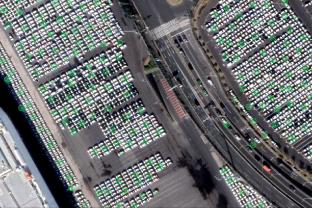
03-1 Car Detection
Provided that a satellite can take a picture of hundreds of square kilometers at once, and that all squ ares are car detection, how many cars are there in the image? It is only a matter of seconds for our car detector to compute this result.
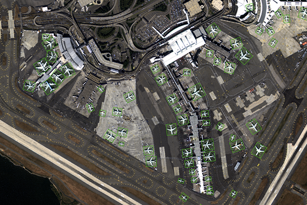
03-2 Aircraft Detection
The Aircraft types normally seen are very consistent. For example, under normal operating conditions we would find. But unusual activity spikes can sometimes be caused when other aircarft are brought to the airfield. Our OVISION platform alert on specific date, referencing aircraft on the area. OVISION supporting analysts by flagging abnormal behaviors, identifying the cause of these and their location on each image. The combination of automated model classification coupled with location recognition enables defence analysts to quickly determine the context of this activity peak.
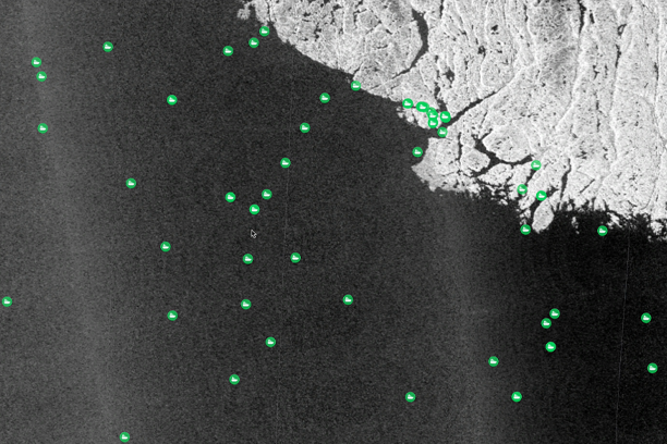
03-3 Vessel Detection
Illegal, unreported, and unregulated(IUU) fishing is a major threat to human food supply, marine ecosystem health, and geopolitical stability. Dark vessels don’t have identification systems so they can not be tracked. With SAR image, we could see every boat on the ocean, regardless of weather conditions or restricted waters.
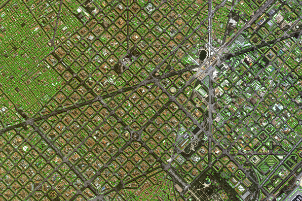
03-4 Building Segmentation
Building Segmentation is an important part of the automated satellite image interpretation problem. Building Segmentation enables creation of maps, detecting changes, and monitoring urbanization.
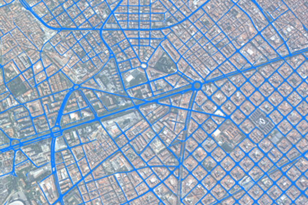
03-5 Road Segmentation
Road network detection from overhead imagery is of great interest to a diverse set of disciplines, from humanitarian crises to autonomous vehicles. Road mapping remains especially challenging in broad expanses of underdeveloped regions.
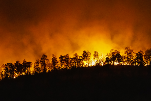
03-6 Monitoring Damage of Natural Disaster
Earthquakes, volcanic eruptions, floods, and wildfires are natural phenomena that require rapid but strategic resp onses to prevent or minimize significant damages. Earth Observation data can enable responders to identify the location, cause and severity of impacts, including property damage. Our AI Model was used at disaster events and supported in minimizing disaster damage and labor-intensive.Brochure Download
We prepare the brochure for you the more information.
Get the booklet, and keen your BIZ ideas up.
Contact to more Information
Get in touch with our sales team
please fill out the form below.
Partner